Programs Admissions Our Work Student Experience About
Programs
Undergraduate Programs Graduate Programs Certficate Programs High School Summer Program
Admissions
Scholarships and Financial Aid Visit Information Sessions
Our Work
Faculty Research Professional Practice Student Work Research Centers & Institutes Research Labs Galleries and Exhibits
Student Experience
Campus to Capitol Mentoring Programs Student Organizations Spaces and Studio Education Abroad Competitions Professional Development Student Resources Alumni
About
People News and Events Accreditation Contact Us Giving
Undergraduate Programs Graduate Programs Certficate Programs High School Summer Program
Scholarships and Financial Aid Visit Information Sessions
Faculty Research Professional Practice Student Work Research Centers & Institutes Research Labs Galleries and Exhibits
Campus to Capitol Mentoring Programs Student Organizations Spaces and Studio Education Abroad Competitions Professional Development Student Resources Alumni
People News and Events Accreditation Contact Us Giving

Linking Vulnerability to Urban Flooding and Infrastructure

Home Linking Vulnerability to Urban Flooding and Infrastructure

Urban Flooding, Infrastructure, and its Link to Social Vulnerability and Mobility: A Place-Based Study in Washington, D.C. 

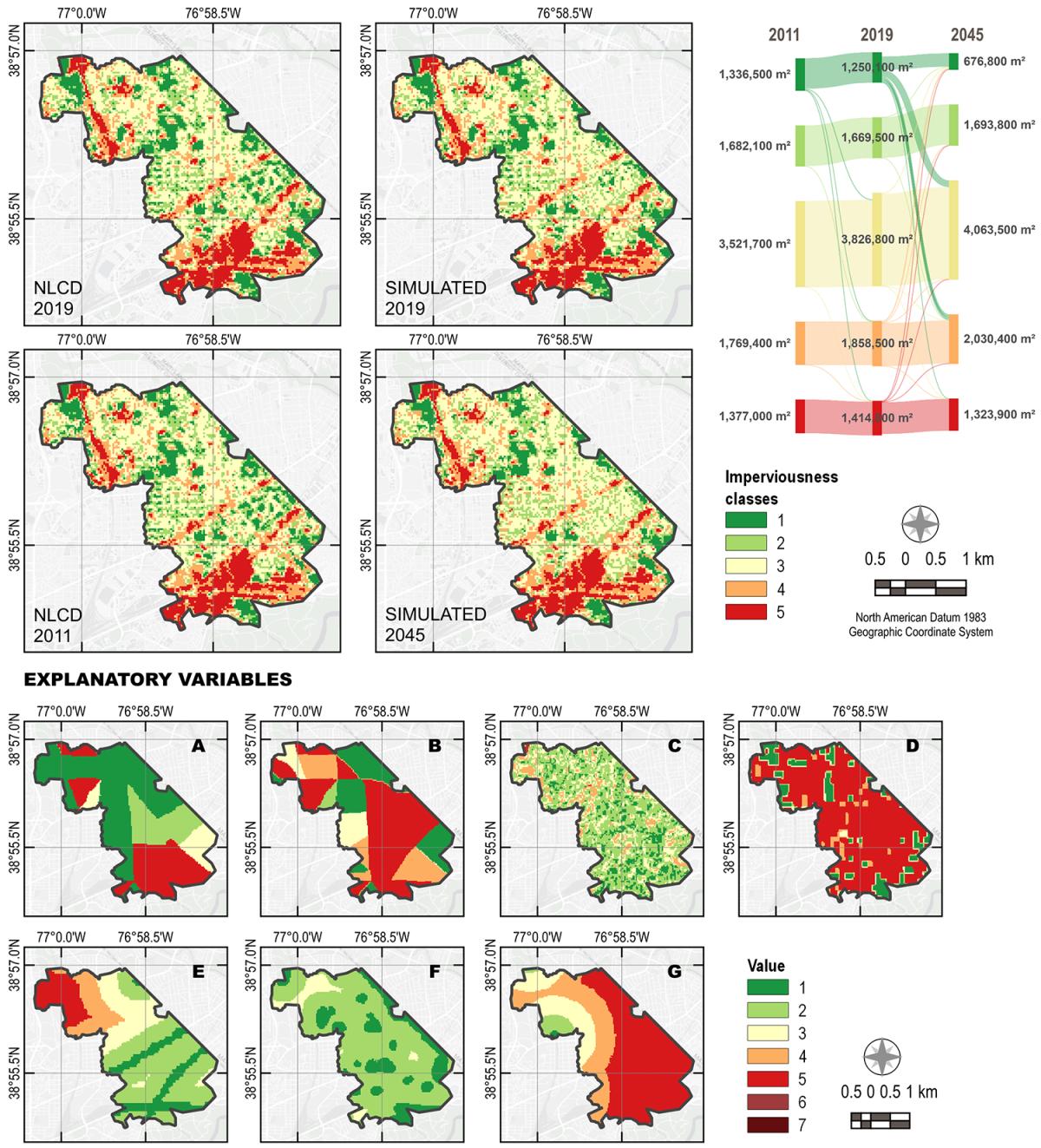
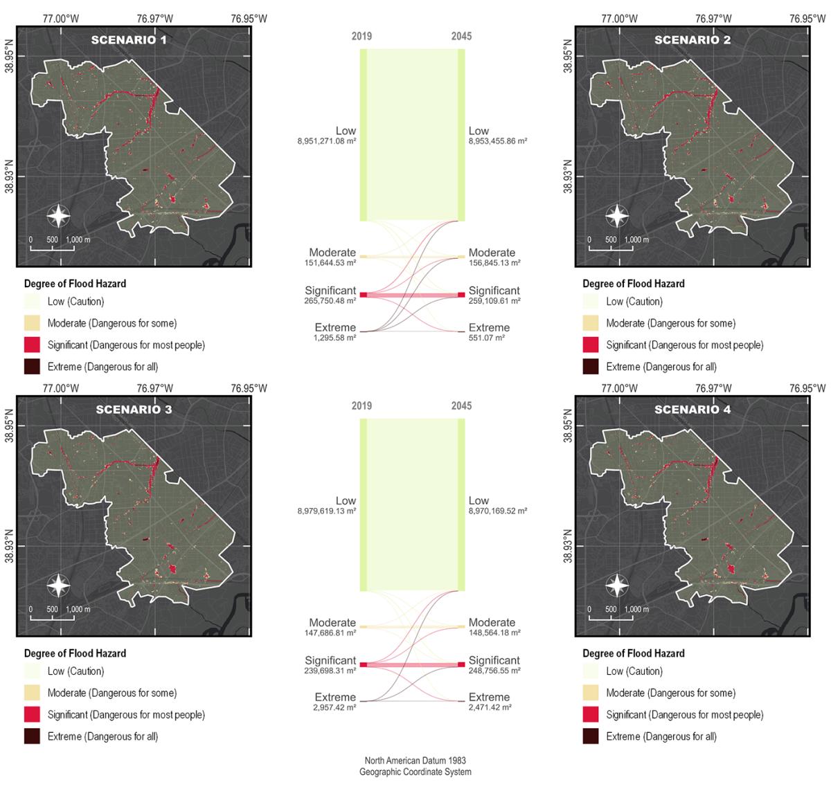
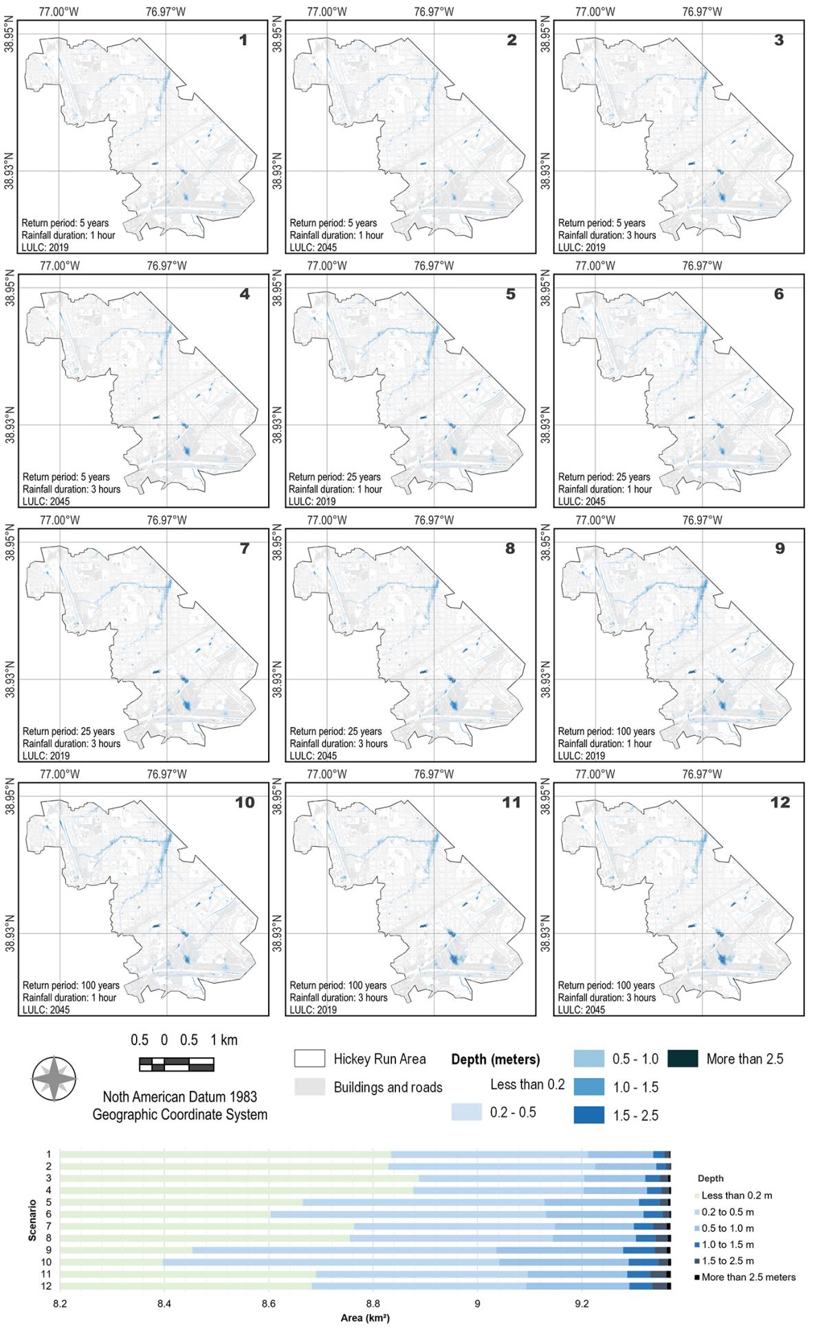
This study explores infrastructure, flooding and its connection to social vulnerability and mobility in Washington, D.C. We use secondary flood and infrastructure data to model flood risks and exposures and subsequent infrastructure failures to understand the extent to which flooding reduces the quality and serviceability of infrastructure, including public transit, schools, energy and community facilities that provide essential services. We also use primary interview data to further contextualize flood impacts and whether repeated flooding creates a negative cycle that prohibits social mobility, particularly among socially vulnerable populations.

Infographic of Urban flooding with different colors showing the imperviousness classes from 1 (green) to 5 (red)
Infographic showing degrees of flood hazard on a urban site map
A series of sitemaps showing the rainfall duration and depth over time
School of Architecture, Planning and Preservation
3835 Campus Drive, College Park, MD 20742
archinfo@umd.edu 301.405.8000